Entertainment
 Sightseeing
 Food establishments


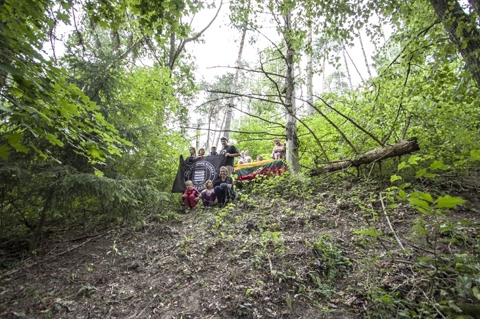
Varkališkiai II Hillfort

603

0

0
0 out of 5
(0 reviews)
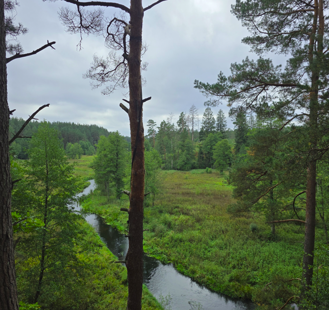
The hillfort is located on the western part of a promontory of the upper terrace of the Nemunas River, 300 meters northwest of the first hillfort (separated by another promontory).
 54.770167, 24.159889
The hillfort is located on the western part of a promontory of the upper terrace of the Nemunas River, 300 meters northwest of the first hillfort (separated by another promontory). The platform is oval, elongated in a northeast-southwest direction, measuring 43×25 meters, with a 2-meter high middle and a 2-meter lower northwest end. At the northeast end, there is a 0.5-meter high, 18-meter wide rampart. On the northeastern slope, 1.5 meters below the platform, an 8-meter wide, 0.5-meter deep, 4-meter wide ditch has been dug, behind which a second 7-meter long, 1-meter high from the bottom of the ditch, 11-meter wide curved rampart has been built. 2 meters below this rampart, a second 3-meter wide, 1-meter deep ditch has been dug, and behind it, a third 2-meter wide rampart has been formed, turning into a 3-meter wide terrace. 2.5 meters below this terrace, there is
a wide gully with a 12-meter wide bottom, separating the hillfort from the adjacent highland. At the northwest end of the platform, a 5-meter wide, 0.2-meter deep ditch has been dug, behind which a 0.2-meter high, 7-meter wide rampart has been built, with a 9-meter wide terrace behind it. The slopes are steep, up to 40 meters high. The hillfort is situated in a spruce forest.
The hillfort is dated to the 1st millennium.
It can be reached from the Kruonis-Darsūniškis road (road No. 1803) by turning right (north) immediately after the Varkališkiai forest and driving to the current mouth of the Lapainė River. From there, continue along the Nemunas River for another 400 meters (it is in the forest, at a slight bend to the northeast - now at the border of the older forest and the young growth - walk 50 meters east into the forest (hill on the right (south))).
Found a mistake?
Report
Whats new?
2025-11-17
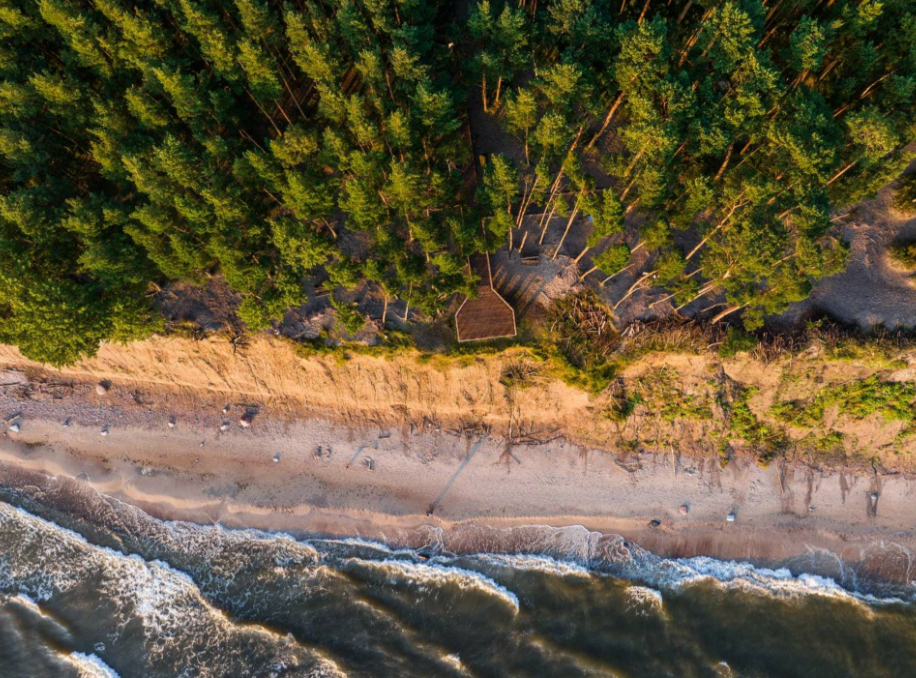
Three impressive Baltic seaside spots: Olando Kepurė, Veczemē Cliffs, Pakri Cliffs
The Baltic coast is a place where the land and the sea are in constant conversation. Where waves sha...
Read more
2025-11-13
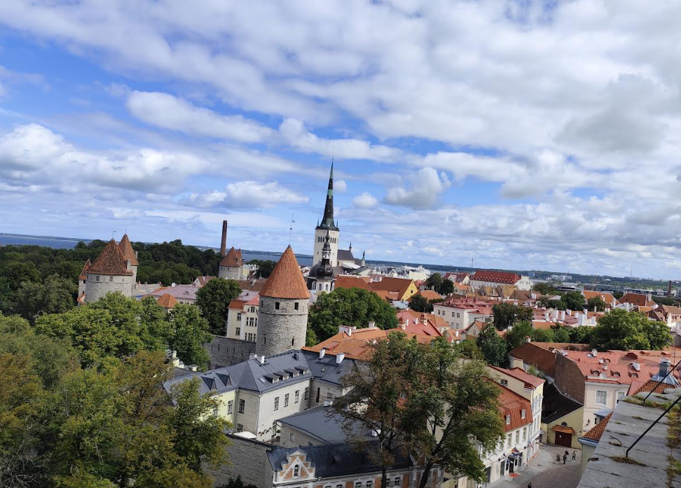
Discover Tallinn Old Town with MyTravis: a medieval spirit that surprises you at every step
Tallinn’s Old Town is like an open-air museum. A member of the MyTravis team, after visiting Estonia...
Read more
2025-11-12
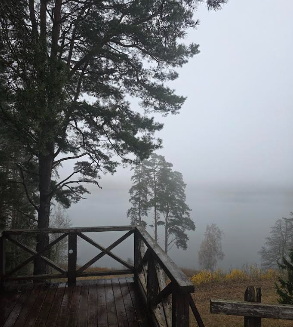
Women's hike through the mystery of the fog from Ginučiai Hillfort to Ladakalnis
The third Women's Hike was organized by the club's founder, Ada Vėtrė, whose idea to bring women tog...
Read more
2025-09-24
The first women’s hiking club hike in Marcinkonys: nature’s beauty, legends, and togetherness in Dzūkija
On September 20, the first Women’s Hiking Club hike took place in Marcinkonys, organized by the club...
Read more
2025-06-15
Nature Trails in the Pärnu Region: A Journey Through Estonia’s Natural Treasures
The Pärnu region of Estonia is renowned not only for its resort town and coastline but also for its...
Read more
2025-03-30
Šiauliai Chestnut Alley – a place where dozens of chestnut trees bloom
Chestnut Alley in Šiauliai – a unique spot in the heart of the city, where the beauty and delightful...
Read more
2025-03-29
Kulautuva – the Pearl of the Nemunas Shore: What to See and Do?
Kulautuva – a small but charming town in the Kaunas district, surrounded by pine forests and stretch...
Read more
2025-03-28
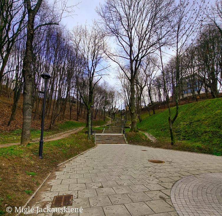
Kauko Stairs in Kaunas – Woven with Myths and Natural Beauty
Kauko Stairs – a favorite spot for both locals and visitors of Kaunas, where the extraordinary beaut...
Read more
2025-03-27
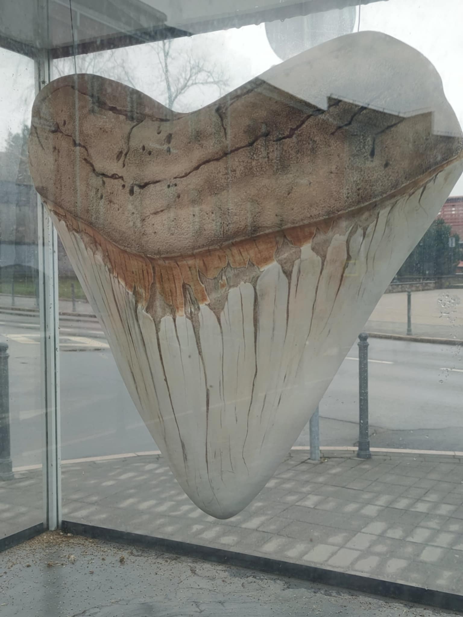
Kaunas Beast: A City Symbol Shrouded in Legends
Not every ordinary Kaunas resident knows what secrets lie behind the historic walls of Kaunas Castle...
Read more
Info
Mytravis
Cities
A life full of travel is a source of good mood!
© 2026 MyTravis - All rights reserved | Privacy policy